Glacio-karstic landscape
The term glacio-karstic refers to two separate processes that may operate to modify the landscape in limestone areas. Karstification is the process by which limestone rock is dissolved by water. This may result in widened cracks in the rock, underground caves and aquifers and the eventual reduction of the rock. In Ireland, the process of karstification in limestone areas has been modified by the action of large sheets of ice that moved across the country during and towards the end of the last ice age. These ice sheets swept away the partially dissolved or broken rock that would have lain on the surface of the landscape, to leave the bare limestone pavements that occur in south Co. Galway and the Burren district of north Co. Clare. They also left behind in places, deposits of boulders and gravel, forming drumlins and eskers. In shallow basins they left thin deposits of till that lined the surface and helped to create turloughs.
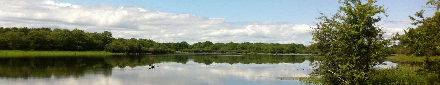
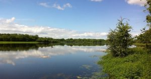 Coole-Garryland Nature Reserve is located in the glacio-karstic landscape of the Gort lowlands, Co. Galway. It is the centre of a unique wetland system.
Water draining from the bogs of the sandstone Slieve Aughty Mountains to the east makes its way, via a combination of over ground and underground routes, to Coole Lough. It brings with it, silt from the mountains.
At the same time, water draining from the limestone lands of the Burren, to the south, makes its way north towards Coole, via underground channels, and fills Newtown turlough. This water is very unusual in a European context. Despite the fact that it has as its source a limestone area, the water is in fact, poorer in nutrients than the water coming in to Coole Lough from the Slieve Aughty Mountains. At high water levels, Newtown and Coole loughs merge.
The water makes its way from Coole, via an alternating series of turloughs and underground pathways, to eventually reach the sea at Kinvara.
Coole Lough itself is a large turlough and like most turloughs, empties underground through “swallow holes” in its lake bed. It has the largest range in water level fluctuation of any turlough in Ireland. Water levels in the lake can fluctuate by over 10m. The lake generally does not fully empty in summer however and usually retains a small area of permanent water.
A remarkable feature of the turloughs at Coole and Garryland is their close association with woodland. Indeed, large areas of woodland in the nature reserve are covered by water in winter. Plants that live in the turlough must be able to survive both prolonged inundation and drought. Carpets of silverweed (Potentilla anserina) with its silver leaves and yellow flowers may be seen in summer when the water levels have retreated. In certain turloughs, the rare fen violet (Viola persicifolia) may be found. In fact, this plant has its stronghold in Ireland at Coole Lough. Other rare turlough plants found at Coole-Garryland Nature Reserve include shoreweed (Litorella uniflora), and a species of starwort (Callitriche palustris).
Turloughs are classified as Priority habitats under the EU Habitats Directive owing to the rarity of this habitat in a European and world context. The habitat is almost unique to Ireland.
“Global Importance”
Its location at the centre of a unique and complex karstic aquatic system makes Coole wetland complex a site of Global importance. The extreme level of fluctuation of the lake water level, the unusual close association of the turlough with woodland, the large assemblage of wetland plant communities and the combination of interesting species associated with the lake goes to make Coole Lough the most important turlough in Ireland – and thus in the world.
Turlough
A turlough – from the Irish “tuar” meaning dry and “loch” meaning lake – is usually located in a closed depression in limestone areas, where the underlying bedrock has been karstified and fissured. During the last ice-age, the massive sheets of ice deposited a thin layer of glacial till on the bed of the lake. Water is able to penetrate the lake bed through the weak points in the till, known as “swallow holes”. When groundwater levels are high, water under pressure, enters the turlough via the swallow holes. As groundwater levels drop, the lake may empty via the same swallow holes.
In summer, when water levels are low and the land is dry, the presence of a characteristic plant of this habitat, the black moss Cinclidotus fontinaloides , is a very good indicator that an area forms part of a turlough. This moss may cover rocks, trees and walls that are inundated at high water levels.